Laurens County
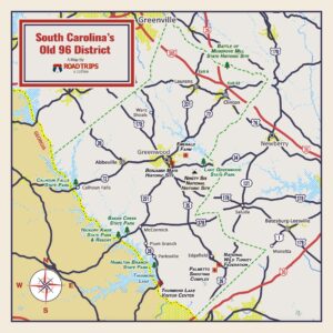
NAME: Kellett’s Blockhouse, Laurens County
MARKER: The cemetery on Knickerbocker Road (S-30-308). The bridge over South Rabon’s Creek on Knickerbocker Road is named, “Joseph Kellett’s Revolutionary War Block House Memorial Bridge”.
GPS COORDINATES: 34.611160N 82.223190W
ACTION: About 1778. Local frontiersman Joseph Kellett built a blockhouse. At this location, several actions were fought against the British and Tories, plus the Indians during the Revolution. The Kellett’s Blockhouse battle was fought overnight on September 3-4, 1781. The Tories then burned the blockhouse. Joseph Kellett, his wife, and several sons are buried in graves marked by native stones, with no decipherable inscriptions.
NAME: Lindley’s (Lyndley’s) Fort, Laurens County
MARKER: Historical Marker on Fort Lindley Road (S-30-398)
GPS COORDINATES: 34.454870N 82.115810W
ACTION: July 15, 1776. SC Major Jonathan Downs, with the help of a company of men, turned away an attack on this frontier fort by Tories and Indians. The victory encouraged the American cause locally.
NAME: Hammond’s Store, Laurens County
MARKER: 1.3 miles off SC Hwy 72 on Green Plains Road (S-30-50). The site is near the house on the left.
GPS COORDINATES: 34.425700N 81.878200W
ACTION: December 1780. American Brig. Lt. Col. William Washington, with his 3rd Continental Light Dragoons and 200 of Maj. James McCall’s SC State Cavalry were dispatched by Gen. Daniel Morgan to attack about 250 Georgia Tories under the command of Georgia Loyalist militia Col. Thomas Waters. Col. Waters and his troops had been attacking the homes of Americans from Ninety Six to Winnsboro. The Patriots surprised the enemy camped at Hammond’s Old Store just west of the Bush River. When the fight concluded, 150 Tories were killed or wounded, and 40 were taken prisoner. Waters and 60 men escaped. Under pursuit, they found the safety of allies at Fort Williams, several miles away.
NAME: Hurricane Meeting House, Laurens County
MARKER: Hurricane Church Road (S-30-34), 1.6 miles off US Hwy 76. The church is on the right and the field, now a “potters field” burial ground where the action took place, is on the left.
GPS COORDINATES: 34.465870N 81.822920W
ACTION: December 29, 1780. On the way to Hammond’s Store, Patriots captured three stragglers from the Tory force. These stragglers were likely captured in the vicinity of the Hurricane Meeting House. The captured Tories divulged information, identifying the Tory’s location and the number of men at the Hammond’s Store. Part of the Hammond’s Store action occurred in the open field directly across from the church.
NAME: Duncan Creek Meeting House, Laurens County
MARKER: East on SC Hwy 72, left onto Duncan Creek Church Road (S-30-34). The church and graveyard are on the right. A tablet on the inside wall memorializes 16 members of this congregation who fought for the Americans in the Revolution.
GPS COORDINATES: 34.520200N 81.808060W
ACTION: December 13, 1781. “Short John” Callaghan was in Roebuck’s Battalion of the Spartan Regiment (SC militia) served under Capt. Christopher Casey, during 1781. Callaghan was the only casualty listed for either side in this engagement. The congregation was organized in 1764, and its beautiful rock sanctuary was built in 1844. There are several Revolutionary War soldiers buried in the Duncan Creek Presbyterian Church graveyard.
NAME: O’Dell’s Ford, Laurens County
MARKER: From I-26, go west on SC Hwy 72 (Clinton Hwy). Turn right onto Lover’s Lane and go about 1.1 miles. Turn left onto Lakestone Drive and go about 1.1 miles to the site.
GPS COORDINATES: 34.53366N 81.64351W
ACTION: February 1781. A group of Tories camped at John O’Dell’s house, near O’Dell’s Ford on the Enoree River. Under the command of Capt. Isaac Shelby, along with Capts. Casey of Newberry, Elder and Berry from the Tyger River area, Patriots fired on the house. Rain forced the Patriots to shelter. After the rain, the Patriots returned to O’Dell’s house only to find that the Tories had fled.
NAME: Battle of Musgrove Site, Laurens County
MARKER: Historical marker at SC Hwy 56 between Musgrove Road and the bridge over the Enoree River.
GPS COORDINATES:
ACTION: August 19, 1780. Loyalist had gathered at Edward Musgrove’s Mill on the Enoree River. A small skirmish broke out, which alerted British officers and lured British troops into an ambush. Disorder set in and the British fled, leaving 63 dead, 90 wounded and 70 taken as prisoners. Very few Patriots were killed or wounded, and the battle proved that multistate cooperation amongst American Militia could defeat redcoat British regulars.
 More than 200 Revolutionary War Battles Were Fought in South Carolina

 NAME:
NAME: